Sunday, October 17, 2010

Peggy's Cove

We are once more in Glen Margret near Peggy's Cove and camped at Wayside Camping. I am once again amazed by the beauty of the place and the fantastic view. This is what we see when we look out our front window!


Just up the road from where we are staying was this fantastic house / museum. Although the museum was closed the building was a true work of art. How many hours must have gone into this pain job.

Peggy's Cove is supposedly one of the most photographed places in Canada and I was snapping just like the rest of the gang. This picturesque village was supposed to have gotten its name from a young girl who got shipwrecked on the rocks while on route to Halifax. From then onward the villagers began referring to her as Peggy of the cove.
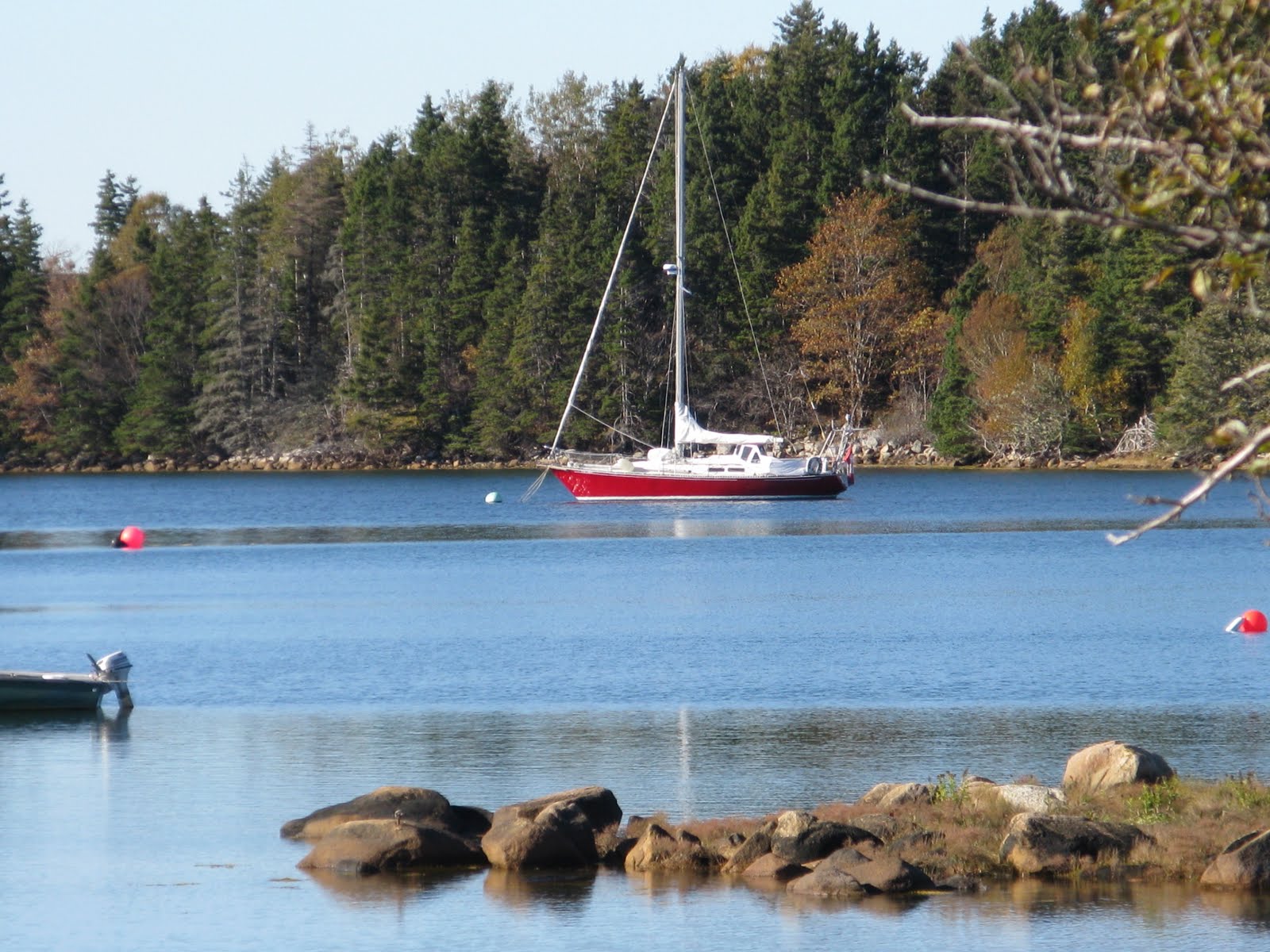
While the boats are harboured safely in the calm cove the sea displayed its strength and fury just outside the protected cove


You see many signs warning people to stay off the rocks but as you can see the signs often go ignored. It is no wonder there have been several deaths due to carelessness.

Good Bye Newfoundland


October 11 2010


We leave St. Johns this morning headed for Port aux Basque and the ferry which will take us acoss to Sydney, Nova Scotia and the mainland. We have had a memorable visit to Newfoundland with its unusual ruggedness and awe inspiring beauty.


So many communities still have fishing as a prominent trade and their docks and coves harbour all from the small dingys to the large fishing ships with their fishing gear jutting form their decks.
There are also some who dare to farm in this rugged rocky place with sometimes only a scattering of soil.


Brave souls all of them, proud of their island and rightly so with its spectacular rugged scenery that is so rich in history. The shores of this island have seen Vikings, Portugees, Spaniards, English, French and who knows how many more nationalities landed in some point in history. Some settling and some just taking advantage of the rich fishing grounds but all of them leaving their mark in shaping what is Newfoundland today.


We have tried to see as much as possible but have left some stones unturned for our next visit. The leaves are starting to turn their autumn colours and it is time for us to move on.
We will board this fine ship the Leif Erickson and say good bye to Newfoundland. Hope to see you again someday.

Monday, October 11, 2010

Baccalieu Trail Newfoundland

Our adventure today was to tour the Baccalieu trail. The name Baccalieu is derived from the Spanish and Portugese name meaning codfish. As early as 500 years ago fishermen from Portugal, Spain and the Banques crossed the ocean to fish in the rich grounds off this peninsula.

Our first stop on our trip around the Baccalieu Trail was the picturesque village of Cupids. Settled in the 1600`s it is the oldest official British Colony in Canada. In 1612 Nicholas Guire`s wife gave birth to the first recorded birth of an English child on what is now Canadian soil.


At Bay Roberts we saw this whale bone arch marking someone's driveway and although I thought it was pretty unique we saw several more before the day was over.


This is an odd thing to take a picture of but notice the intriguing name.


In Bay Roberts we saw a farmers out selling their produce by the roadside so we stopped and bought the fixins for a Jigg's Dinner. It consisted of cabbage, carrots, turnips and potatoes all in the same bag. This is how it turned out .....m-m-m....Thanksgiving Dinner.G">


At Spaniard's Bay we saw this beautiful and huge Anclican church. I was surprised at how many Anclican churches we saw in Newfoundland.


bp.blogspot.com/_insARTe891U/TLObnHDXw6I/AAAAAAAABZc/q025R2WJZyo/s400/The+Baccalieu+Trail+Newfoundland+017.JPG">

>
V>Although it was threatining to rain Molly and I got to have a little run on the beach at Harbour Grace. It amazes me how the houses are perched pratically on the edge of the cliffs. No foundations needed when you build your house on solid rock!


PLAY: block; HEIGHT: 300px; CURSOR: hand" id=BLOGGER_PHOTO_ID_5526929196636634210 border=0 alt="" src="http://2.bp.blogspot.com/_insARTe891U/TLOY0khC_GI/AAAAAAAABZE/AZDXI7OQQso/s400/The+Baccalieu+Trail+Newfoundland+028.JPG">


We stopped at Bay de Verde which is located almost at the top of the peninsula. The name is Portugese meaning Green Bay. Bay de Verde was initally popular to the French, English, Spanish and Portugese for it's abundant supplies of fish. Caribou was also plentiful in the area and the visiting fishermen hunted them as well. The community is still popular for its fish but is seeing increasing amounts of tourists as well.


At Red Head Cove we found it hard to find a place to perch long enough to take a picture but the view was spectacular. Even on a calm day, which it was, the sea was displaying her power and sheer force.


On to Grates Cove, home of the Grates Cove Rock Walls Historic Site where hundreds of rock walls, formerly used for walling in vegetable gardens and protect them from the grazing sheep, are scattered here and there. It amazes me that people would even attempt farming with so little soil available and the constant battle with rocks and harsh weather is a constant. These are truly hardy souls.


href="http://4.bp.blogspot.com/_insARTe891U/TLOQx_wTCBI/AAAAAAAABYE/AIT-clac46E/s1600/The+Baccalieu+Trail+Newfoundland+066.JPG">


At Heart's Content (yes it is really called that) we again saw the big fishing boats. It was a nice quiet little comunity.


6129650 border=0 alt="" src="http://4.bp.blogspot.com/_insARTe891U/TLOPiwvfI3I/AAAAAAAABX0/rZs4FsKd16Y/s200/The+Baccalieu+Trail+Newfoundland+107.JPG">


At Whiteway we saw the famous landmark called Shag Rock. It has also been called " the shipwrecker" and it is pretty easy to see why!